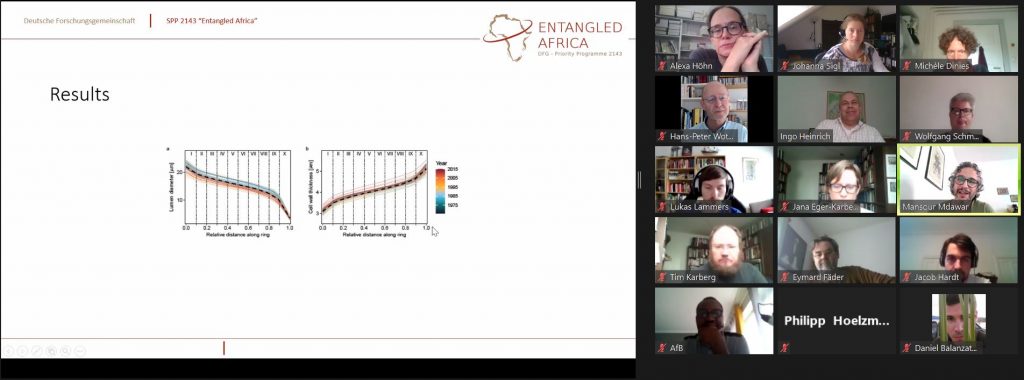
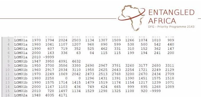
Turning data columns into time and climate models: Dendrochronological work in the ClimCellMed project (data & slide: M. Mdawar; screenshot: J. Sigl).
Natural Sciences and archaeology: Collaborative research for 'Entangled Africa'
Research on past climate and ecosystem changes, land-use patterns and subsistence strategies, as well as landscape transformations is an important component of several ‘Entangled Africa’ projects. On May 11, 2021, members of the Program’s ‘Natural Sciences’ Working Group met to discuss further collaborative research and the management and publication of research data.
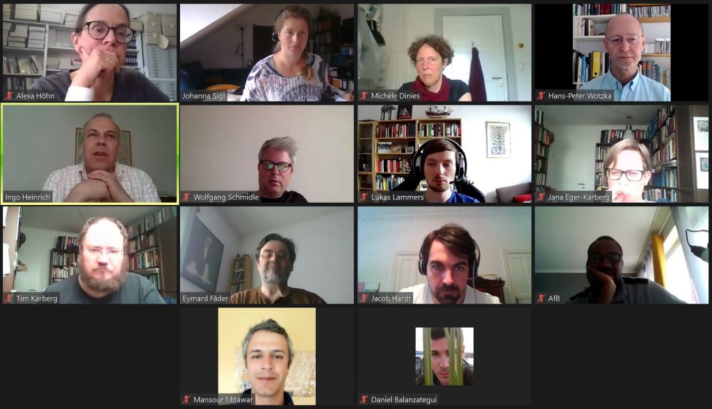
Connected virtually from their home universities or home offices in Berlin, Cologne, Münster and Frankfurt, the meeting began with brief updates on the progress of work in each project. It was impressive to see the progress that has been made despite the restrictions imposed by the pandemic in the last year. It was also the first opportunity to hear the new colleague in the ClimCellMed project, Mansour Mdawar, who presented the dendrochronological work on juniper trees from Turkey and Lebanon. In addition, Jana Eger-Karberg (InterLINK project) and Tim Karberg (DFG funded project Wadi Abu Dom Investigations), who are working on geospatial information from northern Kordofan, Sudan, were welcomed to the group.
Workshop of the Natural Sciences Working Group (Screenshot: J. Sigl).
In line with the understanding that “Entangled Africa“ includes entanglement of people as well as entanglements with and of ecosystems, plants and landscapes, the coherence themes of this working group have developed into several, more specific foci:
Spread and use of crop plants
Environmental constraints, natural occurrences and cultural preferences are supposed to foster the spread and use of crop plants. Based on own, new data and data compilation these entanglements are discussed (Focus projects: Cultivated landscapes & DeGree).
Vegetation maps
Based on own new data and the compilation of published data, vegetation maps including major landscape elements, i.e. lakes, for different time slices are under construction in order to explore and visualize issues such as entanglements between palaeo-environments and the spread of the so-called necked axes (focus projects: DeGree & Necked Axes) or other dissemination processes (upcoming issue for the second project phase).
Comparing vegetation records from Senegal to Sudan and from the Mediterranean coast to the Congo Basin, and exploring possibly related changes in land-use patterns (mainly in Sudan) as well as exploring the results of the climate simulations based on dendro-ecological studies, is an upcoming issue for the second project phase (all projects involved).
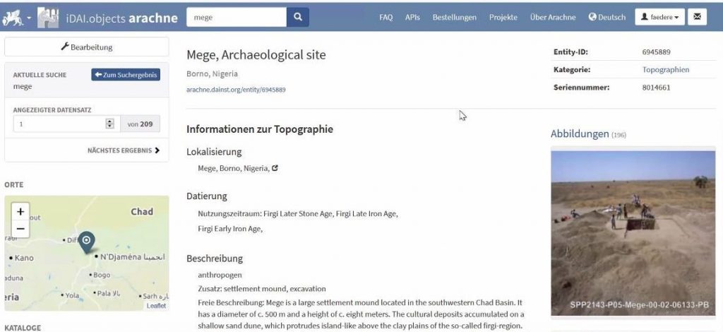
For the Cultivated Landscapes project, initial data has already been mapped in the DAI web service iDAI.objects/Arachne (screenshot: J. Sigl).
The second part of the meeting was dedicated to the discussion and exchange about the possibilities of data curation and management. Following the F.A.I.R. data principles, several Cultivated landscapes and DeGree datasets are being prepared for upload to the Neotoma database platform. Following the November 2020 migration of the database and the recent memorial event for the late Eric Grimm, the data upload is now picking up speed. A first pollen data set (EMIW566) is already available in the system. More palynological data and the Chad Basin charcoal datasets will follow soon.
In addition, the web services of iDAI.welt are used. First images of charcoals and their site Mege at Lake Chad can already be viewed in iDAI.objects/Arachne. A possible repository and exchange platform for the data generated by remote sensing is the iDAI.geoserver. The iDAI.chronontology service can be used for chronological information and the linkage with material culture, for example at Mege. The Learning through connecting project team encourages all participants to contribute relevant data to this flexible “time-space-volume” to facilitate collaboration and the identification of connections within the SPP.
The outcome of the DFG-review of projects which applied for a second phase of funding will now be critical to the implementation of the planned collaborative research and data management work. A next meeting is thus scheduled for fall 2021, when the decision will be pubished.
M. Mdawar presents first results of dendrochronology (data & slide: M. Mdawar; screenshot: J. Sigl).
Workshop participants: Daniel Balanzategui, Jana Eger-Karberg, Eymard Fäder, Jacob Hardt, Ingo Heinrich, Philipp Hoelzmann, Tim Karberg, Lukas Lammers, Judicael Lebamba, Mansour Mdawar, Wolfgang Schmidle, Hans-Peter Wotzka.
Authors: Michèle Dinies, Alexa Höhn, Johanna Sigl.
This website uses cookies to improve your experience while you navigate through the website. Out of these, the cookies that are categorized as necessary are stored on your browser as they are essential for the working of basic functionalities of the website. We also use third-party cookies that help us analyze and understand how you use this website. These cookies will be stored in your browser only with your consent. You also have the option to opt-out of these cookies. But opting out of some of these cookies may affect your browsing experience.
Necessary cookies are absolutely essential for the website to function properly. This category only includes cookies that ensures basic functionalities and security features of the website. These cookies do not store any personal information.
Any cookies that may not be particularly necessary for the website to function and is used specifically to collect user personal data via analytics, ads, other embedded contents are termed as non-necessary cookies. It is mandatory to procure user consent prior to running these cookies on your website.