Berslan Korkut & Ulrich Mania
Year after year, thousands of tourists visit Pergamon, but most only scratch the surface of its rich heritage. They reach the Acropolis by road or cable car, visit areas like the Trajaneum, Athena Sanctuary, palaces, theatre, and Altar Terrace, and then return to the starting point of the short circular route at the top of the city hill. However, the largest part of Pergamon, with its impressive gymnasium, further sanctuaries, the residential city, and peristyle houses adorned with mosaics and wall decorations, remains hidden from their eager eyes, nestled far below the Acropolis.
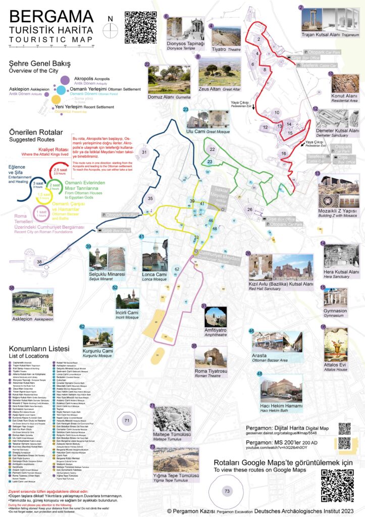
The Pergamon Excavation of the German Archaeological Institute has created a tourist map that not only guides visitors through ancient ruins but also suggests circular routes covering the entire modern city of Bergama. This encourages people to take individual tours and experience Bergama’s rich cultural heritage, from ancient times to more recent periods like Byzantine and Ottoman eras.
The map is distributed across the city, including popular tourist spots, and provides concise information about the sights and suggested routes. Moreover, the convenience of QR codes allows users to easily download the map or access Google Maps, where they can find and follow the recommended visitor routes using the app.
Thousands of viewers via the QR code in a short time prove that the Pergamon tourist map is meeting the needs of many visitors. We hope this offer encourages more people to extend their visit in Pergamon/Bergama, discovering the city’s rich cultural heritage and connecting with its people.


